🦆
Home +
Home
About
Personal Statement
Goal & Objectives
Resume
Extracurriculars +
Extracurriculars
LEO Club
NTHS
SkillsUSA
Interact Club
Miscellaneous
WBL
Internships
ArcGIS
Geographic Information Systems
ArcGIS
Mapping the World: GIS Solutions and Insights
Congressional App Challenge (Fall 2024)
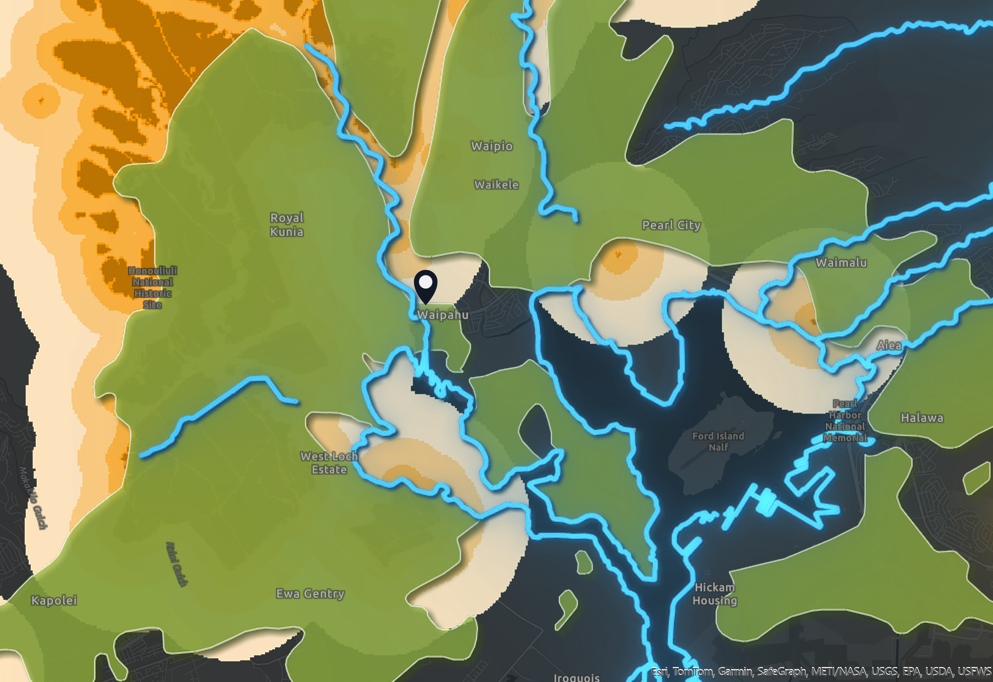
USA Polluted Waters | Hawai'i Sugarcane Plantations | Agriculture UDL
Agriculture Use and Polluted Waters
Congressional App Challenge (Fall 2024)
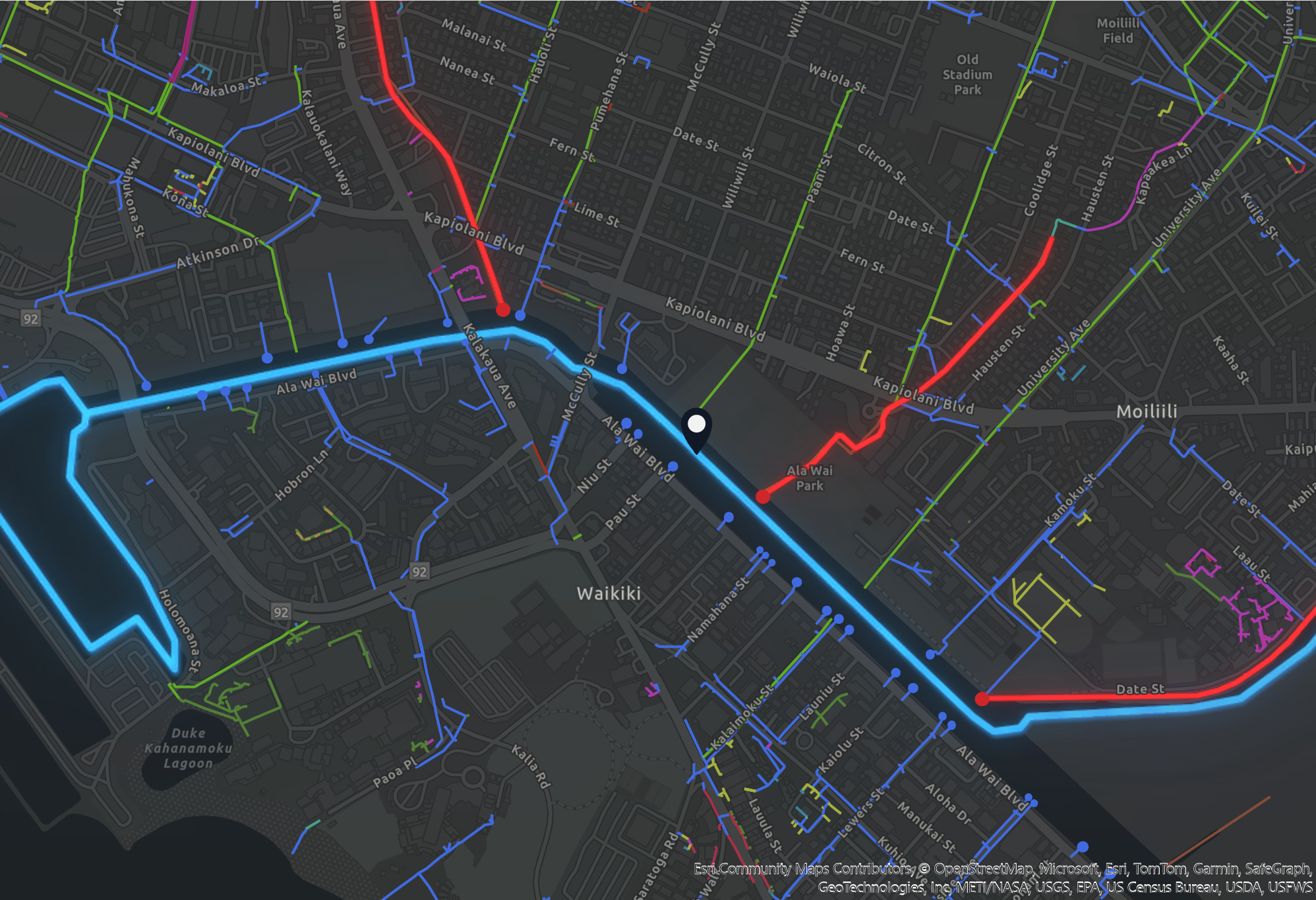
Streams (DAR) | Storm Water Conduits | USA Polluted Waters
Streams & Conduits
Mapping Justice Summer Program (Summer 2024)
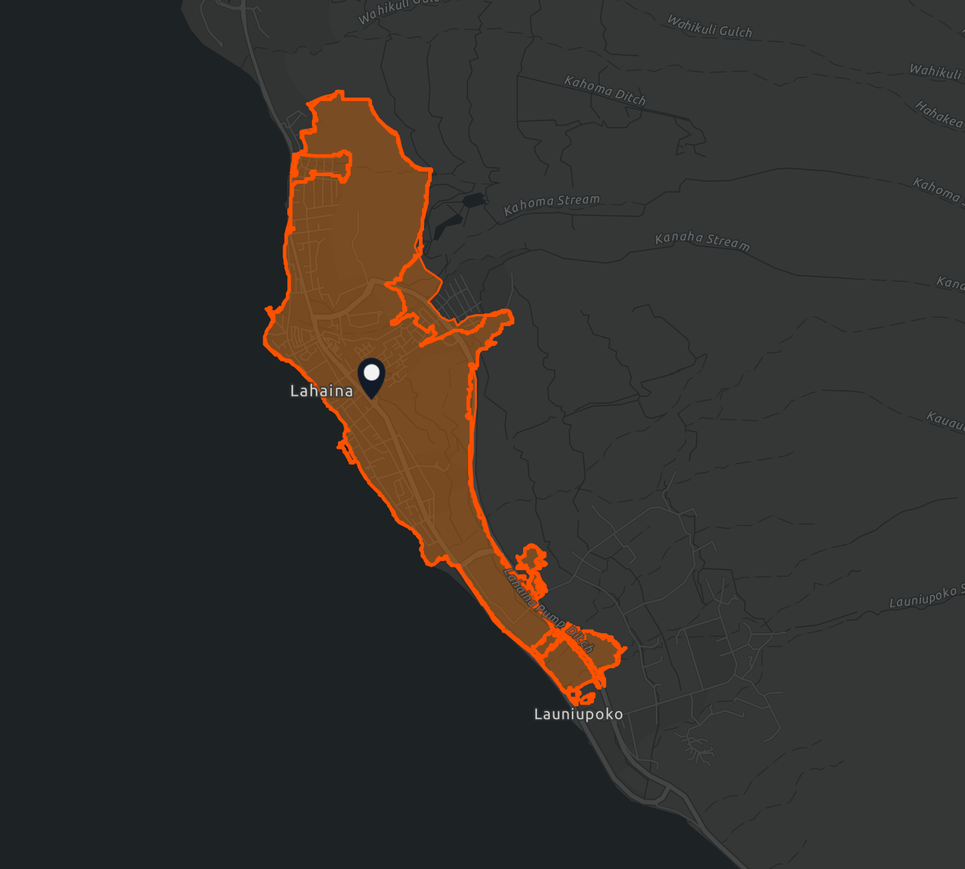
Wildfires in Maui
Mapping Justice Summer Program (Summer 2024)
Lahaina Poverty Extent
Mapping Justice Summer Program (Summer 2024)
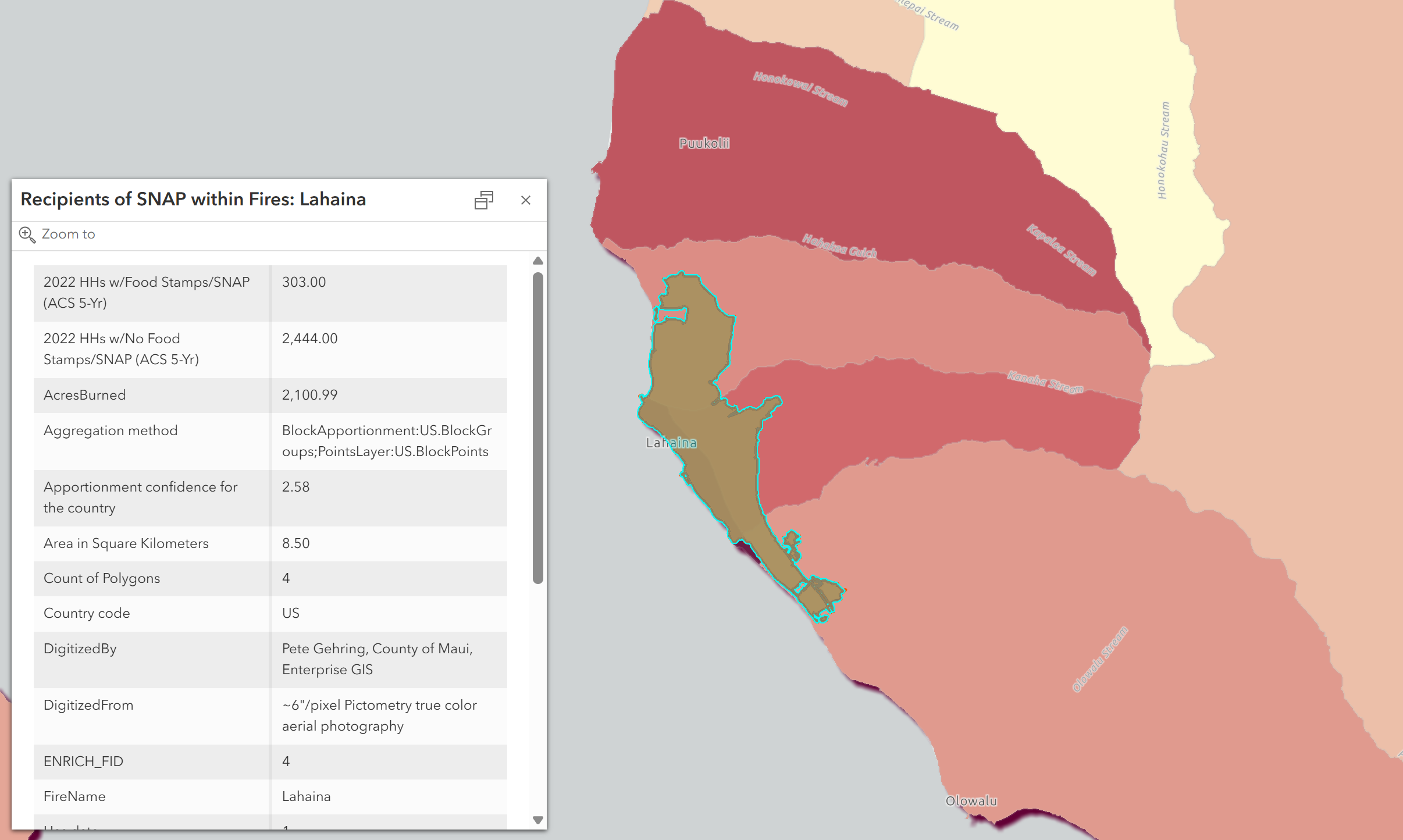
Lahaina SNAP Extent
Mapping Justice Summer Program (Summer 2024)
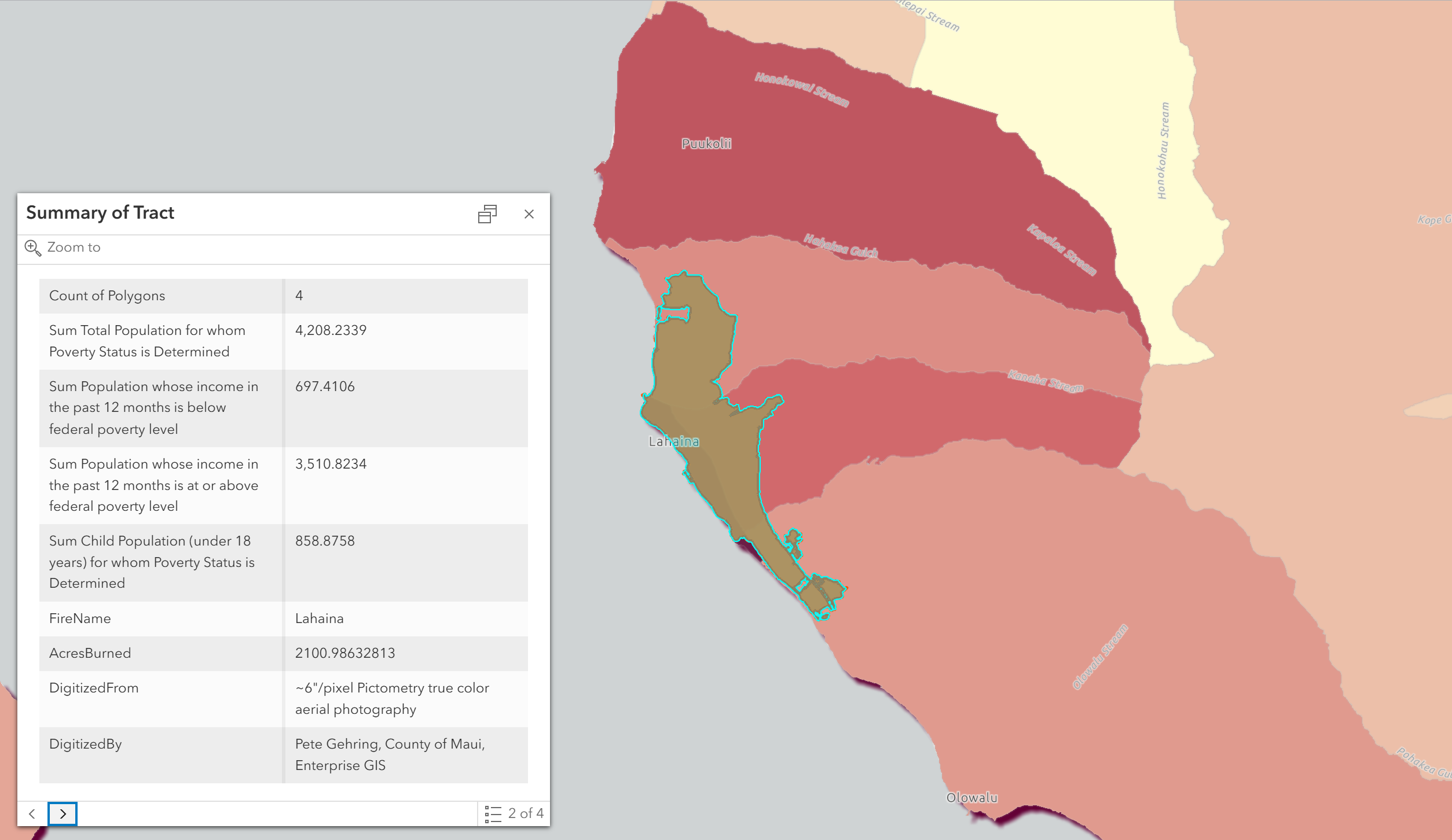
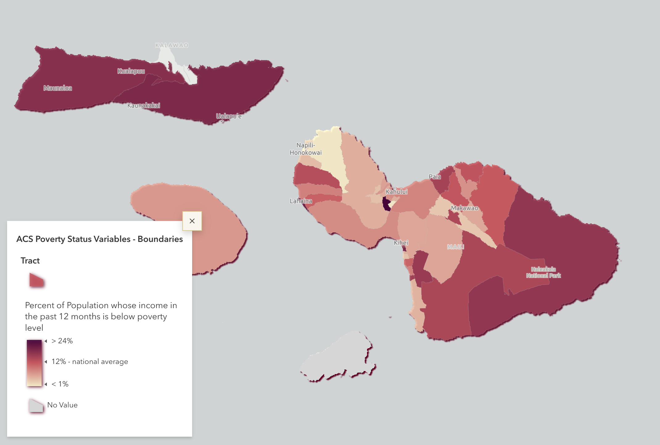
ACS Poverty Status
Maui Poverty Status
Mapping Justice Summer Program (Summer 2024)
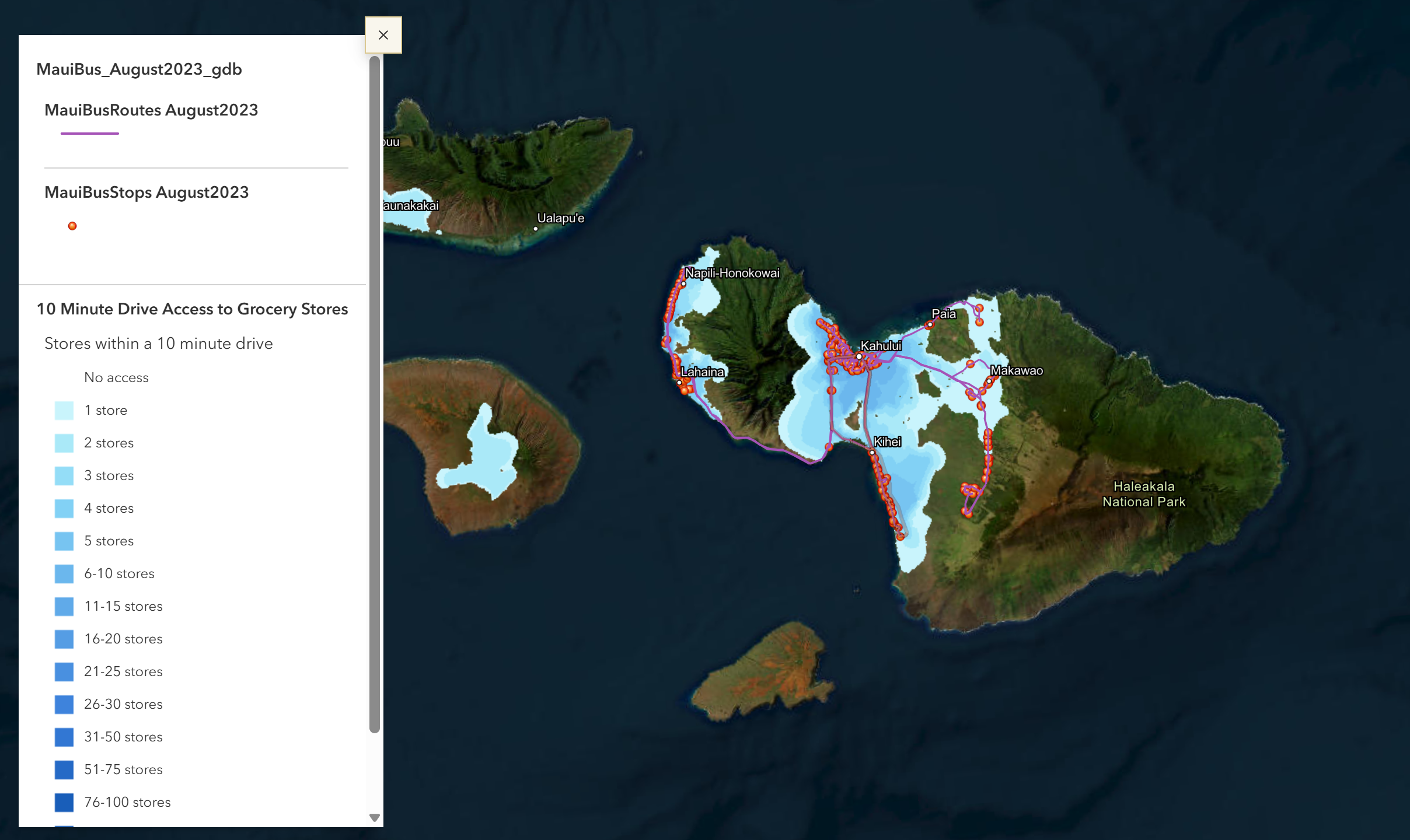
Maui Grocery Stores & Bus Routes
Mapping Justice Summer Program (Summer 2024)
15 Min Drive Time to Grocery Stores
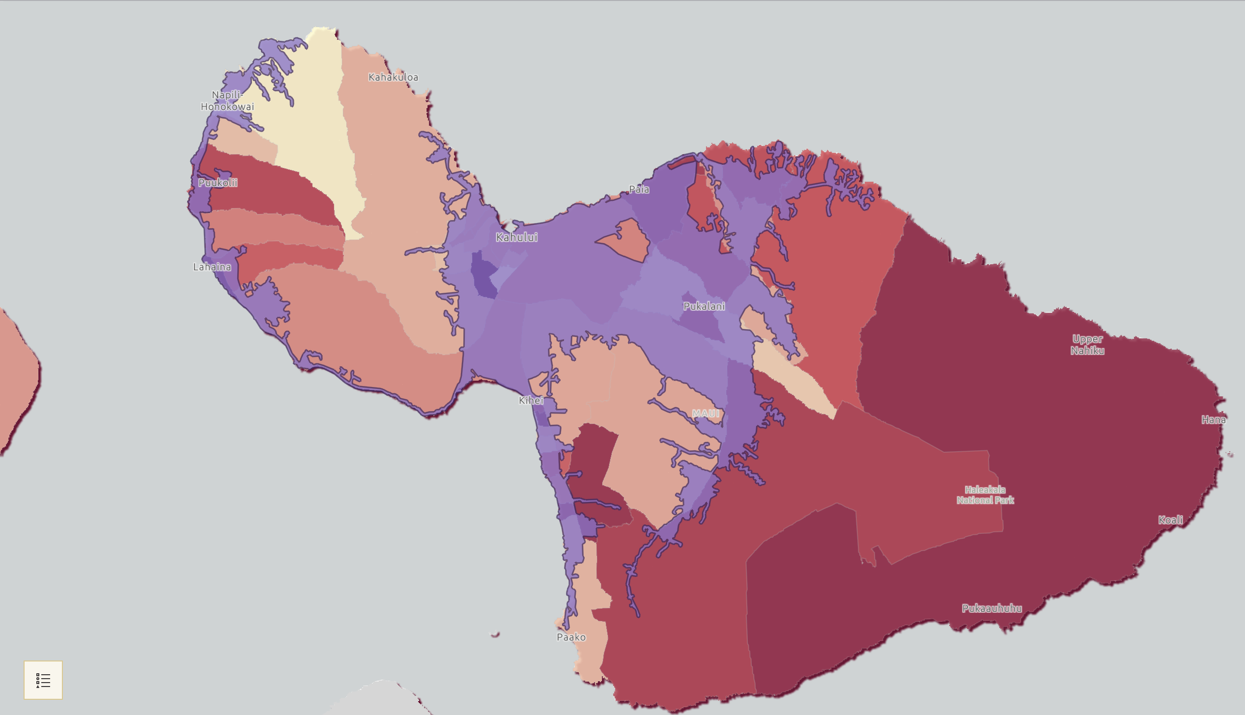
Maui Demographics
Mapping Justice Summer Program (Summer 2024)
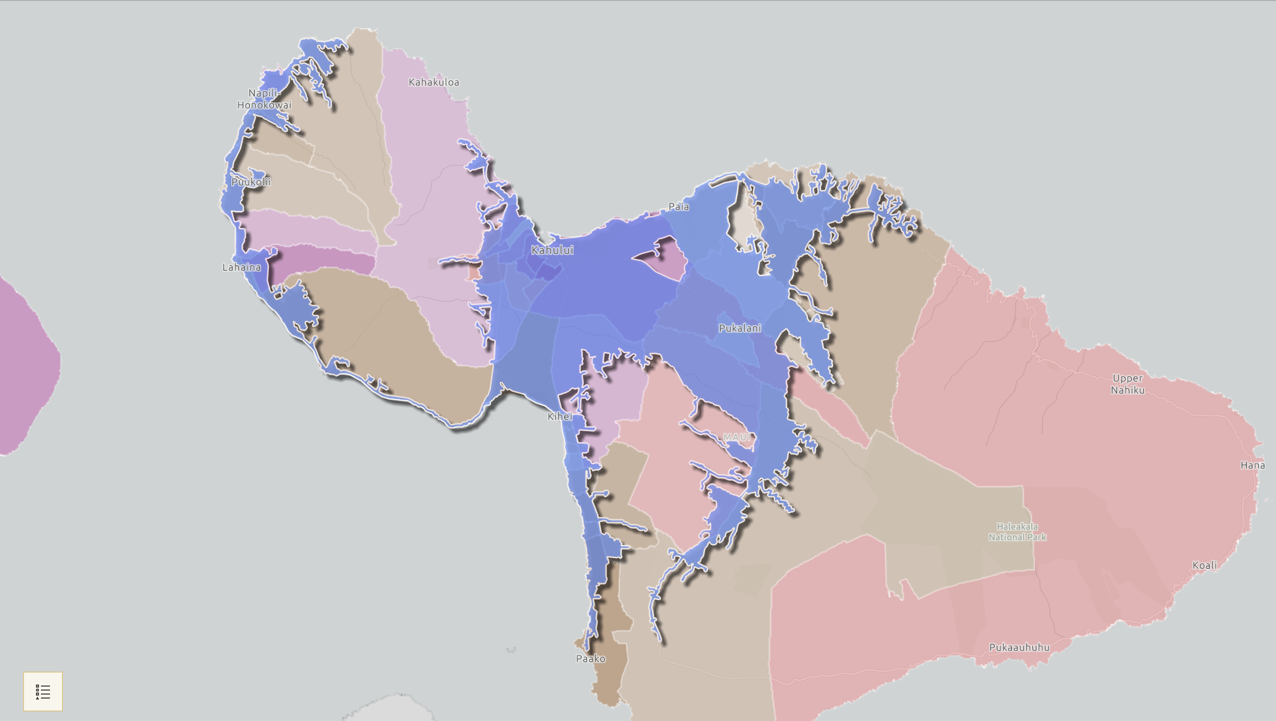
15 Min Drive Time to Grocery Stores
Maui Poverty Status
Mapping Justice Summer Program (Summer 2024)
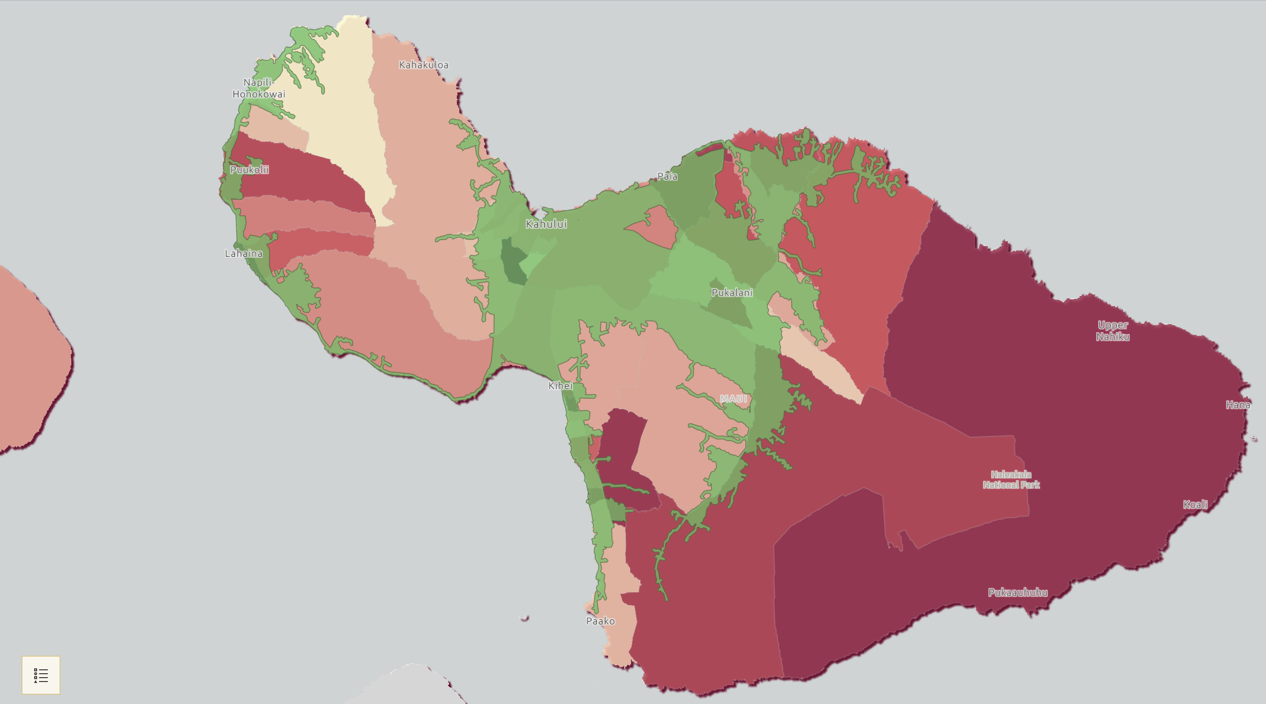
15 Min Drive Time to Grocery Stores
Maui SNAP Status
Interactive Map Showcase: Spatial Challenges & Solutions
Interactive map displays the locations of the maps